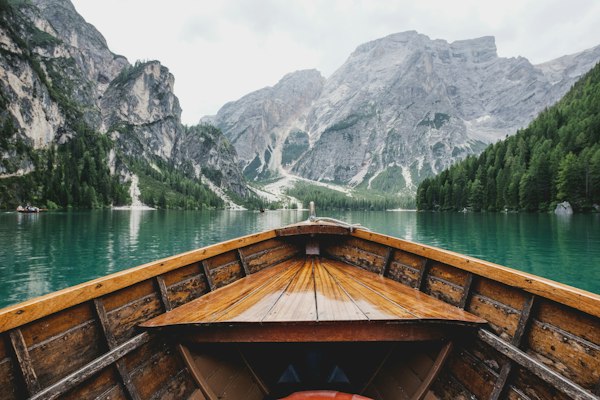
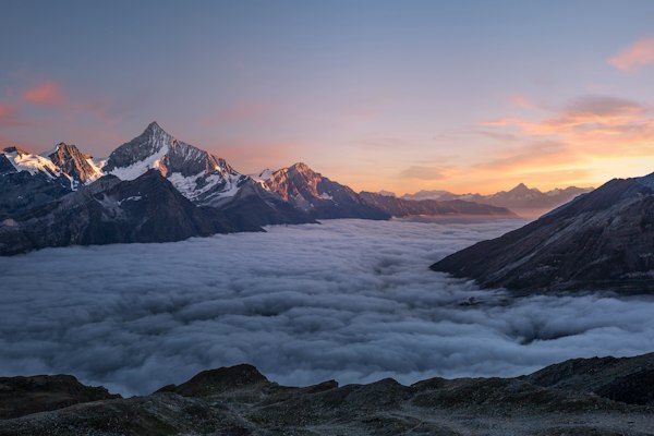
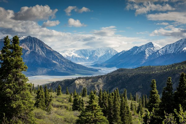
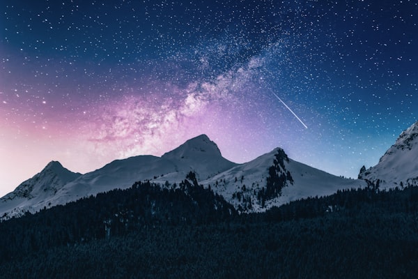
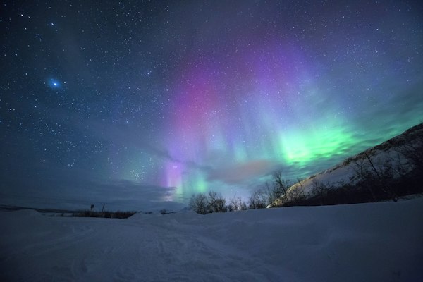
A fjord that drops 1,308m from cliff top to black water with waterfalls visible from the deck of a ship. A sky in February above Tromsø where the Northern Lights play for three unbroken hours. An archipelago above the Arctic Circle where the sun does not set for two months and the fishing villages are painted red against the white mountains. Norway does not do understated versions of its natural phenomena.
Norway (Kongeriket Norge — the Kingdom of Norway — 385,207 km² including Svalbard and Jan Mayen — 5.5 million people — sharing the Scandinavian Peninsula with Sweden, and a border with Finland and Russia in the far north — a coastline of approximately 100,915km when all fjords and islands are measured — longer than the distance from Sydney to London — more than 50,000 islands) is the country that most travel-hardened visitors cite as producing their most viscerally overwhelming natural landscapes. The Sognefjord alone (1,308m deep — 204km long — the longest and deepest fjord in the world — its walls dropping vertically from 1,700m peaks to black water 1,300m below the surface) is a geographic phenomenon at a scale that no photograph conveys accurately, experienced correctly from the deck of a Hurtigruten ship or a local ferry at dawn when the mist is still in the valley and the waterfalls on the cliff face have no visible source.
Norway’s defining experiences divide clearly by season. Winter (November to March) is Northern Lights season: Tromsø (the most accessible Northern Lights city in the world for international visitors — above the Arctic Circle — the aurora is visible on clear nights from September through March — peak activity January–February), the Lofoten Islands (the archipelago above the Arctic Circle where the aurora appears over the red fishing villages and the mountains rising directly from the sea), and the dog sledding and snowshoe wilderness of inland Norway. Summer (May to August) is fjord and Midnight Sun season: the Geirangerfjord (UNESCO World Heritage), the Flåm Railway (the most scenic 20km of railway in Europe), the hike to Preikestolen (Pulpit Rock) and Trolltunga, the Bergen Wharf (Bryggen), and the 24-hour daylight above the Arctic Circle that takes a full day to accept and another to understand.
Each of Norway’s anchor destinations offers a categorically different experience — the country rewards visitors who move beyond the classic fjord circuit.
Norway’s fjords are the defining geographic feature of the country and among the most dramatic landscapes in the world. Three fjords anchor the essential Norway experience: The Sognefjord (the longest (204km) and deepest (1,308m) fjord in the world — the walls rising vertically from black water to snow-capped peaks at 1,700m — the fjord branches into several arms including the Nærøyfjord and the Aurlandsfjord (the fjord visible from the Stegastein viewpoint — the cantilevered viewing platform projecting from a cliff at 650m altitude, 30km southeast of Flåm — the Aurlandsfjord visible as a silver thread 650m below)). The Nærøyfjord (the narrowest UNESCO-listed fjord — 250m wide at its narrowest point — the arm of the Sognefjord that the Norway in a Nutshell ferry traverses between Flåm and Gudvangen — the 2-hour ferry journey through canyon walls so narrow that the ferry appears toy-like against the cliff face — the waterfalls visible directly from the deck — the correct introduction to what a Norwegian fjord actually is). The Geirangerfjord (the 15km arm of the Sunnylvsfjord — the Seven Sisters waterfall (the seven strands of the Geirangelva waterfall falling simultaneously from the cliff directly above the cruise ship deck — the Suitor waterfall on the opposite cliff — the naming convention: the Suitor attempts to woo the Seven Sisters across the fjord — the Norwegian fjord tourism industry’s best story — the context for one of the most photographed scenes in Norway), the Eagle Road (the 11 hairpin bends climbing from the fjord to the Dalsnibba viewpoint at 1,476m — the fjord visible as a narrow black slit between the mountains from the summit)). The Lysefjord (the fjord below Stavanger — the departure point for the Preikestolen (Pulpit Rock) hike — the 2-hour ferry from Stavanger into the Lysefjord gives the first view of the 604m vertical cliff face below Preikestolen from the water level — the correct approach for understanding the scale before the hike).
Tromsø (Tromsø municipality — population 77,000 — 69°40’N — 344km north of the Arctic Circle — the largest city in northern Norway and the world’s most visited city for Northern Lights tourism (a claim supported by direct flight connections from London, Amsterdam, Frankfurt, and Oslo that were established specifically to serve the winter aurora tourism market)) is the city that most Australians travelling to Norway to see the Northern Lights use as their base — correctly. The aurora borealis (the Northern Lights — the natural light display caused by charged solar particles interacting with Earth’s magnetic field at high latitudes — the collisions with atmospheric gases at 80–300km altitude producing light at specific wavelengths: oxygen at ~557nm producing the dominant green, nitrogen producing the blue and violet fringes, oxygen at higher altitudes producing the rare red — the pattern (the curtain, the arc, the corona — the corona being the rare form where the aurora appears to radiate from a single point directly overhead — described by those who have witnessed it as the most spatially disorienting natural event they have encountered)) is visible on clear nights from September through March at Tromsø’s latitude — with peak geomagnetic activity typically occurring January–February. The aurora probability: clear skies and an active KP index (the geomagnetic activity index — KP 3+ is the threshold for visibility at Tromsø’s latitude — KP 5+ produces strong aurora visible to the naked eye — the Space Weather Prediction Center (spaceweather.gov) and the Norwegian Meteorological Institute’s aurora forecast are the two most accurate short-range forecasts) are both required. The guide’s job is to read the sky and drive to the gap in the clouds — Tromsø’s location between the coast and inland mountain valleys means there is almost always a clear-sky zone within 60–90 minutes drive. Tromsø itself: the Arctic Cathedral (the 1965 modernist church — the stained glass end wall — the midnight sun visible through the glass at the summer solstice), the Polaria museum (the Arctic environment exhibitions and the bearded seals), the Tromsø University Museum (the Sami culture exhibition — the Sami being the indigenous people of the Sápmi region across northern Norway, Sweden, Finland, and Russia), and the cable car to Storsteinen (421m above the city — the view of the Tromsø island and the surrounding fjords and mountains — the starting point for the ski resort in winter and the hiking trail system in summer).
The Lofoten archipelago (the chain of islands in the Norwegian Sea at 68°N — 160km north of the Arctic Circle — connected to the mainland by the Lofast road and accessible by ferry from Bodø — the E10 highway running the length of the archipelago across a series of bridges and causeway connections — the islands characterised by dramatic mountain peaks (the Lofoten Wall — the collective name for the mountain ridge that rises directly from the sea with no coastal plain — the mountains 1,000–1,261m high, dropping vertically into the Norwegian Sea — visible from the ferry from Bodø as a single continuous wall before individual peaks become identifiable at closer range)) is the part of Norway that photographers, hikers, and serious Norway travellers consistently rate above the fjords for the specificity of its landscape. Reine (the fishing village — the most photographed village in the Lofoten — the red and yellow rorbu (the traditional Norwegian fisherman’s cabin built on stilts over the water — the rorbu were originally utilitarian accommodation for seasonal Arctic cod fishermen — many are now available as rental accommodation — staying in a rorbu in Reine is the most cinematically correct accommodation experience in Norway)) and Henningsvær (the village on its own small island — the art galleries, the football pitch on the sea-surrounded rock (one of the most photographed football pitches in the world — the pitch is real and in use), the fish processing factory tours). The Reinebringen hike (the 448m ascent from Reine to the Reinebringen summit — the view across the Reinefjord and the Lofoten islands from the summit is the definitive Lofoten photograph — the trail is steep — the guide recommends poles — allow 3–4 hours return — start at 6am for the light and before other hikers). Cod drying racks: January through April, the cliffs and wooden frames throughout the Lofoten are covered in hanging Arctic cod (Gadus morhua — the skrei — the annual cod migration from the Barents Sea to the Lofoten spawning grounds — 20–50 million individual fish — the cod hung for 3 months to produce stockfish (tørrfisk) — the oldest food preservation tradition in Norway — the stockfish exported to Italy (where it becomes baccalà) and Portugal (bacalhau) for 600 years). The Northern Lights over the Lofoten: the aurora above the red rorbu in winter, with the mountain reflection in the still fjord water, is the image that appears on every Norway tourism campaign and is accurate — it is not a composite.
Bergen (population 285,000 — the second-largest city in Norway — on the west coast at the head of the Byfjord — the gateway city for the Norwegian fjords and the starting point for the Norway in a Nutshell circuit) is the city that most visitors to the fjords pass through and too few stay in long enough. Bryggen (the UNESCO World Heritage wharf — the row of colourful Hanseatic wooden warehouses on Bergen’s harbour front — the buildings date from the reconstruction after the 1702 fire (the original Hanseatic wharf was established in 1360 — the Hanseatic League’s Bergen trading post (the Kontor) was one of four major Hanseatic trade centres in Northern Europe, operating from Bergen from 1360 to 1754 — the 14th and 15th-century architectural character is preserved in the rebuildings after multiple fires — the current buildings mostly 18th century in form but maintaining the 14th-century alleyway and courtyard plan of the Hanseatic settlement)). The Fish Market (Fisketorget — the outdoor harbour market — the king crab, the Arctic shrimp, the Norwegian salmon sold from the stalls directly on the harbour — the quality is good and the price is restaurant-level — the indoor market hall beside it is better value for the same quality). The Fløibanen funicular (the funicular railway from the city centre to Fløyen at 320m — 8 minutes — the view across Bergen’s seven mountains and the harbour from the summit — the hiking trails from Fløyen into the mountain forest (the Skomakerdiket lake at 344m — 20 minutes from the summit station — the goats in the meadow below the lake))). The Flåm Railway (Flåmsbana — the 20km narrow-gauge mountain railway from Myrdal (867m) to Flåm (2m above sea level) — a descent of 865m in 20km — 80% of the line on a gradient of 55‰ (the steepest normal-gauge railway in the world operated without a rack-and-pinion system — the braking systems on each carriage are the engineering solution — the brakes are tested multiple times before each descent — the guide describes this with specific technical detail that passengers find both reassuring and mildly alarming) — the Kjosfossen waterfall (the train stops for 5 minutes at the waterfall — the water volume in summer is significant enough to feel the spray from the platform — the huldra (the mythological Norwegian forest spirit — a beautiful woman with a cow’s tail, associated with waterfalls and mountain meadows — sometimes represented in Kjosfossen performances)).
Norway’s two most iconic hiking destinations represent opposite ends of the difficulty and access spectrum. Preikestolen (Pulpit Rock — the 604m-high flat-topped cliff above the Lysefjord — the cliff face drops vertically to the fjord below — the cliff is approximately 25m × 25m in extent — there are no railings, no barriers, no safety equipment — the Norwegian expectation being that adults assess their own risk tolerance at cliff edges — an expectation that requires recalibration for most Australian visitors who have spent their lives around fenced lookouts). The hike to Preikestolen (the 4km trail from the Preikestolen Mountain Lodge trailhead — 334m ascent — 2 hours each way for average-fitness hikers — rocky and uneven in sections but not technical — the correct approach is via the Lauvvik–Oanes ferry from Stavanger to avoid the road traffic around the fjord — the arrival at the cliff edge with the Lysefjord 604m below and the fjord arms visible in both directions is the most replicated photograph in Norwegian tourism and is exactly as dramatic in person). The Norwegian Scenic Route from Stavanger to the ferry terminal passes through some of the most varied landscape in southern Norway. Trolltunga (Troll’s Tongue — the 700m rock shelf projecting horizontally from the cliff above the Ringedalsvatnet lake in Hardanger — the 28km return hike (1,100m ascent — 8–12 hours return — rated strenuous to difficult — only open July–October due to snow conditions — the hike requires good fitness, hiking boots, and a guide in poor visibility conditions) is harder than Preikestolen but the photograph from the end of the Tongue with the lake 700m below produces the specific image that makes it worth the effort — the queue to take that photograph (peak summer — up to 40-minute wait at the Tongue itself — the practical solution: depart the Skjeggedal trailhead before 6am to arrive at the Tongue before the queue builds)). Kjerag (the Kjeragbolten — the boulder wedged in a crevice 1,000m above the Lysefjord — accessible via a 10km return hike with chains on the steepest sections — harder than Preikestolen, less crowded than Trolltunga — the photograph of standing on the boulder above the fjord is a significant Norway bucket list image).
Oslo (population 700,000 — the capital and most populous city of Norway — at the head of the Oslofjord — surrounded by forested hills (the Oslomarka — the 1,700km² of forested recreational area directly accessible from the city by public transport — 2,600km of marked trails — the relationship between Norwegians and the outdoors is not a metaphor; it is structured into the city’s geography)) is a city that most visitors allocate 2 days and should allocate 3. The Viking Ship Museum (the Vikingskipshuset on Bygdøy — reopening after extensive renovation in 2026 — the three Viking longships (the Oseberg ship (discovered 1904 — built c. 820 CE — the most ornately decorated Viking ship ever found — the carved wooden animal-head posts, the decorative sledges, the burial goods), the Gokstad ship (built c. 890 CE — the largest of the three — the ship that informed the reconstruction of replica Viking ships used in transatlantic crossings), and the Tune ship (the oldest — c. 900 CE — less complete but with original structural timbers visible)). The Oslo Opera House (the Snøhetta-designed building opened 2008 — the white marble and granite exterior slopes directly from the waterline — visitors walk on the roof as a public space — the building design won the Mies van der Rohe Award for European architecture in 2009 — the roof walk at sunset with the Oslofjord spreading south is the correct Oslo experience). Vigeland Park (Frognerparken — the 80-acre sculpture park containing 212 bronze and granite sculptures by Gustav Vigeland (1869–1943) — the central Monolith (the 14.12m granite column carved with 121 intertwined human figures — Vigeland spent 14 years on the Monolith alone — it was carved from a single block of granite by three stone carvers working from Vigeland’s full-scale plaster model — the park is open and free 24 hours a day — the Monolith at midnight in midsummer with the Norwegian twilight behind it is the park at its most otherworldly). The Munch Museum (the 2021 Edvard Munch building on the Oslofjord waterfront — the collection of approximately 28,000 works by Munch (1863–1944) — the world’s largest Munch collection — the two versions of The Scream held here (Munch painted four versions — this museum holds the crayon and tempera versions — the National Gallery holds the 1893 tempera version most reproduced)).
The Hurtigruten (the coastal express ferry service — operating since 1893 — originally the primary connection between Bergen and the remote coastal communities of northern Norway that were inaccessible by road in winter — Bergen to Kirkenes (the Russian border) in 7 days northbound, Kirkenes to Bergen in 6 days southbound, stopping at 34 ports along the route) is the single most comprehensive way to experience Norway’s coastline. The ship carries local passengers, cars, freight, and international tourists — it is a working coastal ferry that also happens to offer one of the world’s great sea journeys. The route passes the Lofoten Islands (Day 4 northbound), the North Cape (the northernmost point of mainland Europe — 71°10’N — visible from the ship), and up to 34 port calls ranging from 15-minute cargo stops to 2-hour town visits. The winter sailing (November–March) offers Northern Lights opportunities from the ship’s deck with an aurora alert service that wakes passengers when the lights are active. The summer sailing (June–July) passes through the Midnight Sun with 24-hour daylight above the Arctic Circle. The original Hurtigruten route is offered by both Hurtigruten AS and Havila Kystruten — book at least 6–12 months ahead for peak season cabins.
The Northern Lights are the most anticipated and most misunderstood natural phenomenon in Norwegian tourism. Two things are required. Neither is guaranteed. Here is how to maximise the probability.
The Northern Lights are caused by charged particles from the Sun (the solar wind — a continuous stream of electrons and protons emitted by the solar corona) interacting with Earth’s magnetic field. At high latitudes, the magnetic field lines converge and “funnel” the charged particles into the upper atmosphere (80–300km altitude). There they collide with atmospheric gas molecules — the collisions excite the electrons in oxygen and nitrogen atoms to higher energy states, and when those electrons return to their ground state, they emit photons at wavelengths specific to each gas. Oxygen at ~557nm produces the dominant bright green — the most common and most photographed colour. Oxygen at higher altitudes (above 200km) produces the rarer red. Nitrogen produces blue and violet fringes. The KP index (the global geomagnetic activity index — ranging 0–9 — the higher the number, the more active the aurora and the further south it is visible) is the primary forecast variable. At Tromsø’s latitude (69°N), KP 3 or above produces visible aurora. KP 5+ produces strong curtain and corona displays. The KP forecast is available 15–30 minutes ahead with reasonable accuracy and 1–3 days ahead with lower accuracy — the reliable planning window is essentially the night itself.
Two things are required: clear sky and geomagnetic activity. Both must occur simultaneously. This is why experienced Norway guides say: book at least 5 nights in Tromsø rather than 3. On a 5-night stay, statistically 2–3 nights will have aurora-visible conditions (the Tromsø area averages approximately 20–25 clear-sky nights per month in winter — combined with typical geomagnetic activity — giving roughly 50–70% probability of seeing the aurora on any given night). The key practical steps: book an aurora chase tour with a local guide (the guide drives away from cloud — the Tromsø coastline’s geography means there is almost always a clear-sky zone within 90 minutes’ drive, even when the city itself is overcast). Dress for −15 to −25°C (base layer, mid layer, wind-proof outer — the guide will advise on rental equipment available in Tromsø). Bring a camera with manual settings (the aurora requires ISO 1600–3200, f/2.8 or wider aperture, and a 5–15 second exposure — a tripod is essential — the guide provides these). Peak activity times: statistically, the aurora is most active between 10pm and 2am — though significant displays can occur from 6pm to 4am. The aurora in February at Tromsø is brighter and more complex than the human eye can track — the camera captures structure and colour that the eye partially misses.
The Polar Night (Mørketid — literally “the dark time”) in Tromsø runs from November 27 to January 15 — 49 days during which the sun does not rise above the horizon. First-time visitors sometimes anticipate this as oppressive and arrive to find it is something else — a specific quality of blue twilight that lasts from approximately 10am to 2pm (the sun below the horizon but close enough that the sky takes on a deep blue gradient, with the mountains and fjord visible in the blue light — Norwegians call this Mørketidslys (polar night light) and it is the light source that Norwegian painters from the 19th century were attempting to capture). The Tromsø population has developed a cultural relationship with the dark season — the café culture, the hygge (the Danish/Norwegian concept of warm convivial atmosphere), the communal light installations (the Tromsø International Film Festival (TIFF — held in January — deliberately in the Polar Night — the cinema as a light source)). Visitors who frame the Polar Night as something to endure rather than observe miss the point entirely.
Norway is often described as expensive — and it is, by almost any comparison. But it is expensive in the way that a landscape that has not been compromised by development is expensive: you are paying for the absence of the thing that ruins other places. The fjords do not have cruise ship infrastructure in the same village as the waterfall. The Lofoten islands are not surrounded by resort development. Tromsø in February is not “the aurora experience with a hot tub package” — it is a city of 77,000 people who live and work above the Arctic Circle, who go on aurora chases as a kind of normal Tuesday evening, and who regard the sky in January with the specific alertness of people who know from experience that the next three hours might be extraordinary.
The cost of Norway is the cost of scale, silence, and the absence of the things that make a landscape less than it could be. It is the destination that almost all who visit describe as worth every krone. The returnvisit rate among Australians who travel to Norway is high — the consistent explanation is that they did not see enough the first time. The correct response to Norway is not to try to see it all in 10 days. It is to decide which version of Norway — the fjords, the Arctic, the hikes, or all three — and to be there long enough to let the weather teach you something.
From a Northern Lights week in Tromsø to the full 14-day Norway circuit — all bookable through Cooee Tours.
The aurora chase package built around the single most important variable: enough nights to guarantee a sighting. Six nights at Tromsø gives a statistical probability of 3–4 opportunities — the combination of clear sky and active KP index. Included: 4 guided aurora chase evenings (the guide reads the cloud and drives to the gap — within 90 minutes of Tromsø, there is almost always clear sky), 1 dog sledding day through the Lyngen Alps snowfields, 1 Tromsø city day (Arctic Cathedral, Mack Brewery (the northernmost brewery in the world — founded 1877), Polaria museum, Storsteinen cable car). Aurora photography briefing on arrival (ISO settings, aperture, exposure length, tripod technique). The guide’s aurora alert wakes the group on nights when the conditions change after midnight — this has produced sightings at 2am on 3 occasions this season.
The definitive Norwegian fjord circuit — the combination of the Bergen Railway, the Flåm Railway, the Nærøyfjord ferry, and Bergen that the Norway in a Nutshell brand packages as a single pass. Structured as a 3-day guided experience rather than the standard self-guided pass: Day 1 Oslo — Bergen Railway (7 hours — the Hardangervidda plateau, the Finse glacier, the Voss mountain section — the most scenic train journey in Northern Europe). Day 2 Bergen — Myrdal — Flåm Railway (the 865m descent in 20km, Kjosfossen waterfall stop) — Nærøyfjord ferry Flåm–Gudvangen (2hrs through the 250m-wide fjord walls, the waterfalls, the silence) — bus Gudvangen–Voss — train Voss–Bergen (overnight). Day 3 Bergen (Bryggen guided walk, Fløibanen funicular, Fish Market).
The Lofoten archipelago — the Norway experience that consistently surpasses the fjords for photographers and serious nature travellers. Fly Oslo–Bodø–Svolvær (or the overnight ferry from Bodø — the correct winter approach). 4 nights across the archipelago: Svolvær (the fishing village at the eastern end — the cod drying racks Jan–Apr — the Svolværgeita (the “Goat” — the twin-peaked rock above the town — a serious rock climb)). Reine (the red rorbu village — the Reinebringen hike: 6am departure, 448m ascent, the definitive Lofoten view). Henningsvær (the football pitch on the sea, the gallery circuit). The E10 drive (the coastal road connecting the islands over bridges and causeways — the mountain profiles changing every 10km — the beach at Uttakleiv (the white sand, the Arctic water at 8°C, the mountains behind)). Winter (Jan–Mar): aurora over the rorbu. Summer (Jun–Aug): Midnight Sun over the Lofoten Wall.
The hike to Norway’s most iconic viewpoint — 604m above the Lysefjord with no barriers and the cliff face dropping straight to the water. The guided approach adds: the Lysefjord ferry from Stavanger (the view of Preikestolen from the water first — the cliff visible as a tiny flat square on the canyon wall 604m above — the scale calibration that makes the hike meaningful). The 4km trail (334m ascent — rocky, exposed in sections — 2hrs each way for average fitness — the guide sets pace, identifies the exposed scramble sections, and manages the group at the edge). Time at the summit (the guide’s approach: arrive at 9am before the 11am crowd peak — the cliff to yourself for 30–40 minutes — the decision of how close to the edge is yours, informed by the guide’s risk context). Return ferry and Stavanger evening.
The Geirangerfjord UNESCO World Heritage experience — the Seven Sisters waterfall, the Eagle Road, and the Dalsnibba viewpoint. Day 1: fly Oslo–Ålesund (1hr), drive through the Sunnmøre landscape to Geiranger (2hrs — the Atlantic Road (Atlanterhavsveien) optional detour — the bridge over the open Atlantic, the waves in storms visible from the roadway). Arrive Geiranger — the fjord visible from the hotel room. Fjord cruise (the 1.5-hour local boat — the Seven Sisters waterfall seen from water level — the Suitor waterfall opposite — the boat reversing in the final 300m of the fjord to face the waterfalls simultaneously). Day 2: Eagle Road (the 11 hairpins from the fjord to the Dalsnibba viewpoint at 1,476m — the view of the fjord from 1,476m — the snow year-round at the viewpoint — the fjord 1,476m below visible as a narrow blue channel). Return Ålesund (the Art Nouveau architecture — the city rebuilt in Art Nouveau style after a 1904 fire — the Aksla hill viewpoint above the city at sunset).
The Lofoten in winter — the combination of the aurora over the red rorbu, the cod drying season (January–April — the annual migration of 20–50 million Arctic skrei cod — the drying racks covering every available frame on the island), and the snowscapes that photographers specifically travel for. The rorbu in Reine (the fisherman’s cabin on stilts — the aurora visible from the cabin window on active nights). The aurora photography sessions: the guide identifies the clearest sky positions on the islands (the dark beach at Uttakleiv, the viewpoint above Reine, the lake reflections at Flakstadpollen). Snowshoe day through the Moskenesøya interior. The skrei tasting at a local fishery (the fresh skrei sashimi — the Japanese influence on Norwegian cod — the cross-cultural food exchange that exists because Norwegian fishermen export to Japan and Japan sends chefs to observe the drying process). 4 nights consecutive aurora exposure. Statistical probability of at least 2 aurora sightings: approximately 75–80%.
Bergen as a destination rather than a gateway — the city that most Norway visitors pass through too quickly. Day 1: arrive BGO — Bryggen guided walk (the Hanseatic alleyways — the narrow passages between the warehouse buildings that are the 14th-century street plan surviving under 18th-century facades — the guide shows the Schøtstuene (the heated communal assembly rooms the Hanseatic merchants used in winter — one of the only surviving Hanseatic interior spaces in the world)). Fish Market lunch. Fløibanen funicular to Fløyen (the 320m summit — the city laid out across the seven mountains — the walking trail to Skomakerdiket lake). Day 2: Hardangerfjord day trip (the 2-hour ferry from Bergen to Norheimsund — the Hardangerfjord, the fruit orchards on the slopes (the Hardanger apple orchards — the blossom in May — the cider in September), the Steinstø Botanical Garden). Day 3: KODE Art Museums (the four interconnected buildings — the Munch collection, the Stenersen collection — not the National Gallery but the second-most significant public collection in Norway), Bergen Philharmonic Hall (Grieg Hall — the 1978 concert hall — Edvard Grieg’s hometown connection).
Oslo — Scandinavia’s most approachable capital — structured for 3 days of depth rather than 1 day of landmarks. Day 1: Viking Ship Museum (the Oseberg ship — the Gokstad ship — allow 2 hours — the guide’s context for the Viking Age (793–1066 CE) makes the ships comprehensible as operational vessels rather than museum objects), Oslo Opera House roof (the walk from the waterline to the roof — the fjord at sunset). Day 2: Vigeland Park (the Monolith — the 121 figures carved from a single granite block — the guide’s reading of Vigeland’s iconography (the cycle of human life from infancy to death — the anger, the tenderness, the absurdity — the “angry baby” (Sinnataggen — the most reproduced individual sculpture in the park — the toddler mid-tantrum — the guide’s commentary on Norwegian attitudes to public displays of emotion))). Munch Museum afternoon (The Scream context). Day 3: Oslomarka hiking (the forest MRT line to the forest edge — the 2-hour trail circuit from Sognsvann lake — the local hiking culture experienced rather than observed).
The complete Norway in a fortnight — the four essential regions in sequence. Days 1–3: Oslo (Viking Ship Museum, Opera House roof, Vigeland, Munch Museum, Oslomarka). Day 4: Bergen Railway (Oslo–Bergen — 7 hours — the scenic train). Days 4–6: Bergen + Norway in a Nutshell (Bryggen, Fløibanen, Flåm Railway, Nærøyfjord ferry, Stegastein viewpoint). Day 7: Fly Bergen–Ålesund — Geirangerfjord (Seven Sisters boat, Eagle Road). Day 8: Fly Ålesund–Bodø — ferry to Svolvær (Lofoten). Days 8–11: Lofoten Islands (Reine rorbu, Reinebringen hike, Henningsvær, E10 drive, Uttakleiv beach, aurora photography in winter / Midnight Sun in summer). Day 12: Fly Svolvær–Tromsø. Days 12–14: Tromsø (aurora chase x2 evenings in winter / Midnight Sun activities in summer, Arctic Cathedral, dog sledding, Storsteinen). Fly Tromsø–Oslo–home. All accommodation, all internal flights (4), all guided activities included.
Norway does not have a bad season. It has two very different countries: the dark and crystalline winter of the aurora, and the long golden summer of the fjords and the sun that will not leave.
The aurora season. The Northern Lights are visible at Tromsø from September through March — with peak geomagnetic activity in January and February. The Polar Night in Tromsø (November 27–January 15) produces the deep blue twilight that is specific to this latitude and season. Dog sledding, snowshoeing, and reindeer herding with Sami guides are the winter activities. The Lofoten in winter (January–March) combines aurora over the rorbu with the skrei cod migration — one of the most specific nature events in Norway. February is the best single month for aurora probability (clear skies more frequent than January, solar activity typically strong). The fjords are accessible year-round — the Flåm Railway and the Nærøyfjord ferry run in winter — but the lighting is lower and some Eagle Road sections may be closed by snow in December–February. Accommodation costs are 20–30% lower in January–February vs. peak summer.
The fjord and hiking season. May through September is when Norway’s outdoor infrastructure is fully open — the Preikestolen and Trolltunga trails, the Eagle Road to Dalsnibba, the Stegastein viewpoint, the full Hurtigruten schedule, and the Flåm Railway at its most visited. June–July is Midnight Sun season above the Arctic Circle — Tromsø has continuous daylight from May 20 to July 22 — the sun circling the horizon at 1am rather than setting. The first experience of the Midnight Sun (driving at 11:30pm with the sun still 20° above the horizon — the light warm and golden, unchanged from 7pm — the body clock meaningless) is disorienting in a way that can only be resolved by staying in it for 3–4 days. Trolltunga is only accessible July–October (snow until July at 1,100m). The Bergen cherry blossom (April–May) and the Hardanger apple blossom (May) are seasonal highlights. Accommodation costs are at their highest — book 6–12 months ahead for Lofoten rorbu in summer.
April (the snowmelt — the waterfalls at their highest volume (the winter snowpack melting produces the maximum flow at Geirangerfjord’s Seven Sisters — the waterfalls in April are at 3–4x their summer volume — the spray visible from 500m) — the aurora still possible in early April above the Arctic Circle — the Lofoten cod season still running until mid-April — the Preikestolen trail open from mid-April — the Hardangerfjord cherry blossom (late April at 200m altitude)). October (the autumn colour in the Norwegian valleys — the birch forest turning gold in late September / early October — the aurora returning after the summer white nights — the first aurora of the season in late August/September is always remarkable after months of absence — the Lofoten in October: the mountains reflected in the calm fjords, the colours, the returning dark, the rorbu available at shoulder rates). Both months carry 15–25% lower prices than peak season with significantly fewer visitors at major sites.
The Sami (the indigenous people of Sápmi — the region spanning northern Norway, Sweden, Finland, and the Kola Peninsula of Russia — approximately 100,000 Sami people across Sápmi — approximately 40,000 in Norway) maintain a cultural calendar that intersects with the Norwegian winter travel season in two significant ways. Sami National Day (February 6 — celebrated across northern Norway with traditional joik (the Sami form of vocal music — the personal song — each Sami person has their own joik, which belongs to them as a personal identifier and can be sung by others as a mark of respect), traditional dress (the gákti), and community events visible in Tromsø, Alta, and Kautokeino). Sami Easter (the annual Sami Easter festival in Kautokeino — the largest Sami cultural event of the year — the reindeer racing on the frozen river, the joik concerts, the traditional market — occurring in March or April depending on Easter — one of the most culturally distinctive events in the Nordic calendar — Cooee Tours can incorporate Kautokeino into custom winter itineraries for visitors interested in Sami cultural encounter beyond the “feed a reindeer” tourist experience).
Three structures — from the 7-night fjord focus to the full 14-day Norway circuit including Lofoten and Tromsø.