🗺️ Area by Area
Brisbane Neighbourhoods
Brisbane is a city of distinct pockets separated by a looping river, and which one you spend time in changes the trip more than most visitors expect.
Brisbane is a city of distinct pockets separated by a looping river, and which one you spend time in changes the trip more than most visitors expect.
The Brisbane River loops through the city in a series of tight bends, and almost every neighbourhood here is defined by which side of a bend it sits on. That geography is why two suburbs a kilometre apart as the crow flies can feel entirely separate, and why the CityCat is often quicker than the road.
The city centre occupies a peninsula inside a river bend, which makes it compact and easy to walk. The Queen Street Mall runs through the middle as the retail spine, and it is entirely smoke-free.
The CBD is busiest on weekdays and noticeably quiet on Sunday evenings — a genuine surprise for visitors from larger cities. Staying here puts you at the transport interchanges and within walking distance of the Botanic Gardens, City Hall and the river.
Good for: first visits, short stays, business, and anyone who wants to walk everywhere. Less good for: atmosphere after dark, and parking, which is expensive.
Directly across the river from the CBD and connected by three pedestrian-friendly bridges. This is the cultural heart: GOMA, the Queensland Art Gallery, the Queensland Museum and the State Library sit in one riverside row, all free to enter.
South Bank Parklands runs alongside with Streets Beach, a lifeguard-patrolled swimming lagoon, and the Arbour walkway. Grey Street and Little Stanley Street carry the restaurants.
Good for: families, culture, anyone who wants green space and the river. Less good for: a quiet stay — the parklands are busy every weekend.
Full South Bank and South Brisbane guide →
The Valley is Brisbane's nightlife district and has been for decades. Live music venues, bars and clubs concentrate here, and it is loud late on Friday and Saturday.
It also holds James Street, which is a completely different proposition — designer retail, good restaurants and the city's most polished dining strip. The two coexist a few hundred metres apart.
Chinatown Mall sits in the middle with some of the best-value eating in the inner city.
Good for: nightlife, dining, shopping. Less good for: sleeping, if your window faces the wrong way on a weekend.
Downriver from the Valley, these two run together along the water and are the inner city's most liveable stretch. New Farm Park covers fifteen hectares of riverside lawn under enormous Moreton Bay figs, with the Brisbane Powerhouse arts venue at its edge.
Teneriffe's converted wool stores are the architectural signature — heavy brick warehouses now apartments, with the river walk running past them.
Brunswick Street carries the cafes. The Saturday farmers market at the Powerhouse is one of the best in the city.
Good for: cafes, walking, a genuinely local weekend. Less good for: being in the middle of things — it is a fifteen-minute ferry from the CBD.
Full New Farm and Teneriffe guide →
Across the river on the southern side, West End is the city's most eclectic inner suburb — Vietnamese, Greek and Middle Eastern food along Boundary Street, independent shops, and Davies Park market under the figs on Saturday mornings.
It is walkable to South Bank in about fifteen minutes and has a distinctly different feel — scruffier, cheaper and less polished than the north side.
Good for: eating, markets, atmosphere. Less good for: transport, which is bus-dependent rather than rail.
A narrow peninsula directly opposite the CBD, defined by the cliffs — twenty metres of volcanic rock left by nineteenth-century quarrying, floodlit at night and used for climbing.
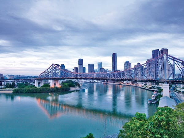
The riverside promenade at the base connects the Story Bridge to the Goodwill Bridge, and the clifftop lookouts on River Terrace give the best accessible city view that does not involve driving to Mount Coot-tha.
Good for: views, walking, being close to the city without being in it. Less good for: shops and dining, which are limited.
North-west of the CBD and up the hills, these are the classic Queenslander suburbs — timber houses on stumps with wide verandahs and tin roofs, built for the climate before air conditioning.
Given Terrace runs through Paddington with antique shops, cafes and restaurants. The streets themselves are the attraction: this is the Brisbane that appears in the television series Bluey, which is made and set here.
Good for: architecture, a walk with no particular destination. Less good for: anyone who dislikes hills, of which there are many.
Full Paddington & Red Hill guide →
Not a suburb but worth knowing: a former shipyard directly beneath the Story Bridge on the CBD side, derelict for decades and redeveloped into a riverside precinct with a brewery, restaurants and open parkland.
It connects to the CBD along the Riverwalk in about fifteen minutes on foot and is one of the better places in Brisbane to be at sunset.
Full Howard Smith Wharves guide →
Every journey costs fifty cents, whichever mode you use, so moving around is close to free.
The CityCat is the nicest way and often the fastest, because the river cuts across bends the roads have to go around. It serves the CBD, South Bank, Kangaroo Point, New Farm, Teneriffe, Bulimba and Hamilton. The CityHopper between inner-city terminals is free outright.
On foot, the CBD to South Bank is about ten minutes over Victoria Bridge or the Goodwill Bridge, and the Riverwalk carries you from the city to New Farm in about forty.
Cooee Tours acknowledges the Turrbal and Yuggera (Jagera) peoples as the Traditional Custodians of the land on which Brisbane stands. We pay respect to Elders past, present and emerging.
Transfers, charters and guided days across South-East Queensland. Family owned and operating since 1974.
Ask us